


Published on the 24/04/2009 | Written by Phil Parent
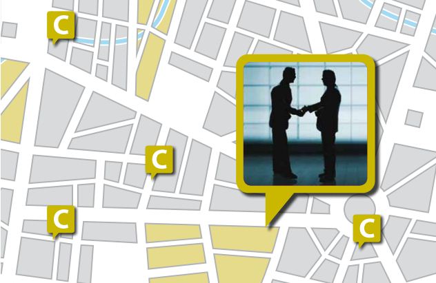
Putting your customers on the map, using the newer GIS and GPS services, will help you find them – and sell the right products to the right people…
Over the past five years IT has come of age. Performance levels are high, software works better and advances in communications networks now allow information to be used everywhere. In today’s competitive environment, it’s not enough to know just who your customers are. Knowing where they are is equally important, especially if you are providing a service that is location-based, such as power, communication services, deliveries/ pick-ups, or an on-site service such as building inspections or maintenance. Advances in GPS-based (global positioning system) fleet-management solutions have made it much easier to track where your vehicles are at any given time. Now, with similar advances in GIS (geographic information system) technology and geo-coding/address matching, you can see exactly where your customers are located too. “Putting your customers on the map isn’t very hard at all,” says Luigi Cappel, business development manager at GeoSmart Map, an AA subsidiary and New Zealand’s leading geospatial solutions provider, “ – especially if you know their street address.” “Geo-coding gives you the x y coordinates of their location, which, in turn, allows you to accurately place them on the map. Once you have their location mapped, you can do so much more than just see where they are. You can group customers by areas – say, a franchise territory, sales territory or service area – so, when they contact your call centre, you can see immediately which salesperson they should be speaking to or which dispatch depot is closest. So, not only can you give them better information faster over the telephone, but you can also improve your response times – always an advantage in improving customer relationships.” But you do have to pay attention to the details. “While the actual geo-coding process is relatively easy, it is essential that the address data is clean and consistent,” says David Swann, business development director – GIS at Eagle Technology, which distributes leading GIS solution ArcGIS. “Inconsistencies in the address database, no matter how trivial, might lead to errors in the geo-coding process. While this might not be an issue for general work, it could be a major problem if used for emergency services. So, if you are planning to use locational data for key applications, the more accurate the address system, the more accurate the geocoding.” Pre-sales customer service Mapping applications – when combined with socio-economic data provided by the Department of Statistics – can help companies pinpoint neighbourhoods that have the optimal demographics for particular goods or services. “Target marketing using GIS capabilities has been around for a long time,” says GeoSmart’s Cappel. “But it is only relatively recently that it has become cost-effective for smaller businesses. In the past, the costs of the data and application development have been a barrier to more widespread adaptation of the technology. But now, with more liberal data-licensing, businesses can use the same target-marketing techniques that were once the exclusive domain of larger organisations.” CRM, GIS and GPS But one of the most interesting applications is in fleet management and service delivery. It is relatively easy to install GPS in a service delivery vehicle. A GPS transmitter, which sends out and receives synchronised signals to an array of satellites overhead, can calculate a vehicle’s exact location. It then transmits this locational information to the main GPS receiver, where it is then ‘mapped’ onto a digital database and displayed as an icon. With a well-developed CRM/GIS/GPS solution, customer service representatives can track where a service delivery vehicle is located – thanks to the GPS transmitter – and give customers much more accurate estimates of when they can expect deliveries. Similarly, the CRM representative can allocate jobs – in the case of a mobile sales representative, maintenance or security staff – to the vehicle closest to the customer. Linking maps to CRM “These APIs give you the ability in integrate a map interface that can be displayed inside the CRM application. You can control the type of map information you see – streets and roads, addresses, customer locations, depots and other points – as well as user-defined areas (known in mapping jargon as polygons). Operators can open the map interface directly from their CRM application with a click of a button, take care of their particular task and then return to the CRM application.” The growing use of service orientated architecture (SOA) is adding another option for linking GIS to CRM. “With a SOA approach,” says Eagle’s Swann, “you can add the ability to perform map analyses – for instance, buffering or selecting points based on specific criteria – as opposed to a simple map interface. It is this analysis capability that will allow operators to get the most benefit from their GIS databases. The model behind so-called ‘Web 2.0’ supports twoway communication between the browser and with the server. SOA strengthens that two-way communication to not just query a database but to generate new information. It is this analytical capability that provides a much richer user experience.” “The SOA approach to embedding map services into enterprise software such as CRM is the next big thing in application development and delivery,” says Swann. “Almost all the major enterprise application vendors offer some level of SOA integration so that you can plug in rich interfaces to extend the functionality of that application. GIS is a perfect example. By offering advanced GIS map services as a SOA extension, organisations have that much more flexibility when it comes to adding additional value to their IT investments, especially in such areas as BI (business intelligence) and CRM. This combination of software and services is one of the major trends in application development today and offers a tremendous opportunity to build solutions that align IT capabilities with business requirements.” Clouds on the horizon? One of the advantages of cloud computing is that enhancements can be added in the background and then offered to users without any major dramas. In the past, upgrades and enhancements usually entailed a lot of work, as well as requiring additional computing power and application development. And then there was always the hidden danger that any change in the IT structure might have unanticipated results. However, with the cloud computing or SaaS (Software as a Service) model nothing in the office changes except the browser interface. According to a recent IDC report, Asia/Pacific (Excluding Japan) Services Top 10 Predictions 2009, “The low upfront capital outlay and the simplicity of scaling up and down in typical SaaS offerings have attracted a lot of attention. The SaaS and cloud computing phenomenon points to one major market change — the transition from IT solutions that are designed, deployed and managed by an enterprise IT department to IT solutions that are applied and composed by the enterprise but executed and managed by expert third-party providers. IDC sees this as a step towards greater industrialisation of IT into predictable, dependable, professionally managed, plentiful and agile information resources that can be delivered in a more cost-effective way.” CRM is a perfect example of how a traditional application can be extended and enhanced by taking advantage of enabling technologies such as geo-coding, GPS, APIs, SOA and map services. Not only is the application itself richer, but it is now available to smaller businesses as a subscription via SaaS. Working smarter has never been easier. The SaaS model is ideal for us here as we are a nation of small- to medium-sized businesses. We don’t have money to burn and any technology that can help us cut costs, while maintaining services, is going to do well. SaaS-based CRM delivers on both counts. “The SaaS model works very well for all parties,” says James Beamish-White, director of Teiq, Sugar CRM’s partner in New Zealand. “Clients like it because they can have all of the advantages of enterprise solutions without any of the support issues associated with running major applications. Plus, because SaaS is, by definition, browser-based, users can access it from any browser, anywhere. SaaS is scalable as well, so adding capacity is easy. We like it because we can control all the development, support and service on our own system. We are firm believers in the future of web-based services and see SaaS as a growing trend. Research backs this up. According to Springboard Research, a leader in the IT market research industry, lower cost of ownership is the most significant reason for adopting SaaS for enterprises in Australia and New Zealand (ANZ). In its report, SaaS in ANZ: A Fast Maturing Market, Springboard forecasts that the ANZ SaaS market will register a compound annual growth rate of 55 percent between 2007 and 2011, and reach A$683 million (US$444 million) by 2011. The report also highlights that SaaS deployment among ANZ enterprises is far from maturity, with the majority of respondents currently using SaaS applications in isolation. Only 20 percent of respondents have integrated SaaS applications with traditional enterprise applications, and fewer still have enabled integration between SaaS applications. “Just look at the web-based applications that Google is offering,” concludes Beamish-White. “They have email, calendars, documents and more. Users can create, modify and share all sorts of information. Right now, they are targeting individuals, but business and enterprise applications can’t be far away. The best part of all of this is that businesses will be able to get all the benefits of powerful, scalable and mature specialist applications on demand for a fraction of the startup costs that are the rule today.” But Cloud Computing? What is that? Modelling weather forecasts from cumulous patterns? Predicting air quality from smog horizons? Cloud Computing is a nebulous (pun intended) jargon term that defies logic. It is almost geek code for SaaS that only the initiates can use with impunity. But is there a difference between SaaS and Cloud Computing? Maybe. Or maybe not. On the surface, they seem to refer to the same thing. But, if you dig a bit deeper, it seems like those offering SaaS more or less limit the customisation that end users can build into their particular application, while those who offer Cloud Computing provide much more flexibility when it comes to interfaces, tasks and, yes, even web services. So, some general rules. SaaS and Cloud Computing both offer applications over the internet. So, you can use the terms interchangeably at the general level. And you can use both terms interchangeably if the particular application is more or less defined with its capabilities. But, if the application can be significantly customised, by altering the subset of web services offered, then it falls into the realm of Cloud Computing. It’s almost the opposite of what you might expect. Cloud Computing sounds more generic but is the more specific technology, while SaaS – which actually alludes to web services – is the catch-all term. But, regardless of the jargon, both models are gaining in popularity and are already having an impact on specific markets such as financials and CRM. …
The best way to keep customers happy is to sell them the right products and services in the first place.
Maintaining and improving customer relationships can be enhanced with the addition of GPS. GPS, originally developed to provide location coordinates for the US military, has been adapted for a multitude of applications including surveying, vehicle theft prevention and in-car navigation.
Adding mapping capabilities to CRM packages is right at the cutting edge of improving customer services. “We have developed a set of APIs (application programming interfaces) that you can plug directly into most of the leading commercially available CRM packages,” says Cappel.
Taking your customer relationship management capabilities to the next level – by integrating GIS and GPS-based services – is a step that can pay dividends in the mid- to long-term, especially if you take advantage of newer service delivery models such as cloud computing.
Hosted CRM saves $$$
Salesforce.com started it all. The company was the first off the block, in 1999, in offering CRM as a web service. In fact, Salesforce was doing SaaS before SaaS even entered the vocabulary. And it has been quite successful. Some 47,700 companies worldwide now use Salesforce to manage their sales, marketing, customer service and other critical business functions.
SaaS vs Cloud Computing – is there a difference?
First came SaaS (Software as a Service) and we all had to get our heads around being able to access our favourite applications from the browser. Then a funny thing happened and, all of a sudden, it was called Cloud Computing. SaaS is a good jargon term. You can almost figure out what it means using logic – software, that’s easy. Everyone knows what software is, but service? Well, that’s a bit more nebulous, but a service is something of value that is provided. In IT terms, most people have some idea about web services, so they can put the two terms together and get at least a general idea of what SaaS refers to.